
Interpreting climate information for improved water safety planning by water utilities
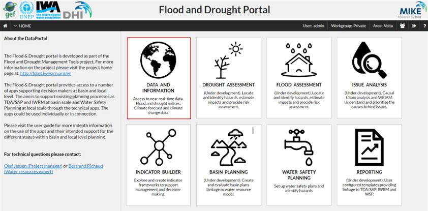
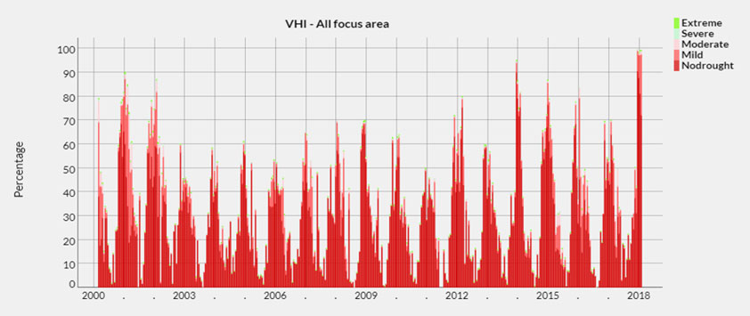
The Flood and Drought Portal (www.flooddroughtmonitor.com) contains a data and information application, which provides near real-time satellite based data, seasonal and medium range climate forecast, climate change projections and different types of data and information relevant for basin and local planning. From discussions with water utilities access to this data is useful, but the challenge is interpretation of the data and how to integrate this into planning and/or operations.
Considering this, the International Water Association (IWA) requested Emanti to develop a set of guidance notes explaining and providing recommendations of how a water utility might use information from selected data sets (e.g. rainfall, temperature, rainfall forecasting, etc.) in their short- to long-term planning. The guidance notes will have a strong focus on the link to Water Safety Planning, particularly relating to hazards and risks, and with consideration of climate resilient water safety plans.
The Flood and Drought Management Tools (FDMT) project (fdmt.iwlearn.org) is funded by the Global Environment Facility (GEF) International Waters (IW) and implemented by UN Environment, with the International Water Association (IWA) and DHI as the executing agencies. The project is developing a package of web-based technical applications (tools), accessible through the Flood and Drought Portal. The tools can be applied individually or together to include information about floods, droughts and future scenarios into planning from the transboundary basin to water utility level. The project is being implemented from 2014 – 2018, and 3 pilot basins (Volta, Lake Victoria and Chao Phraya) have been identified for development and testing of the methodology and technical applications.